Newberry Volcanic National Monument
A Full Day Of Volcanic Exploration
There is so much to explore in and around the Newberry Volcanic National Monument. We spent a full day exploring the area.
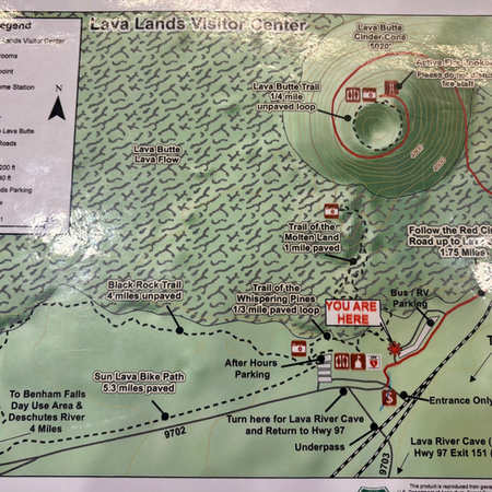
Our first stop was the Lava River Cave. In order to access the Lave Cave, you have to have a car pass to get into the parking lot. These can be purchased on the recreation.gov website. The tour is self-guided and the timed entry gives a two hour window for visiting. We started walking down the approximately 150 steps into the mouth of the cave.
The Lava Cave formed as the hot molten lava traveled in a path, and then hardened on the top and bottom while the inner part of the lava became a cave as the lava finished flowing out what was left was a tube. At the Newberry National Monument, the lava cave is approximately 1 mile out and then another mile to get back. There are several signs throughout the walk that talk about the different formations. This is very kid friendly, however we recommend good shoes and dress for 42° weather and bring 1000 lm flashlights.
Our next stop was a trolley ride to the top of the lava beds to see down into the cinder cone. You can hike up the road or pay five dollars per person for the trolley. We opted to take the trolley and save our steps.
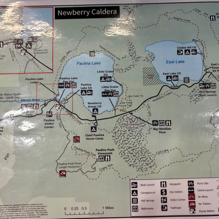
Our third stop was about 40 minutes away ear the site of the volcano, The Big Obsidian Flow Interpretive Trail. This trail starts out as a level path through the woods with one or two signs giving information about the obsidian rocks. You then climb several flights of stairs to a beautiful viewpoint overlooking the prairie grass below. From there we started the hike through the lava rocks. Good shoes and a trekking pole were a must for us. The entire hike is about 3/4 of a mile with a loop partially in between. This was a fun and interesting hike.
Part of the Newberry Volcano area is a beautiful stop at Paulina Falls. The top parking lot was uncrowded and the restrooms were clean. It is a very short, easy walk to the top of the Falls viewpoint. We noticed that there was another viewing platform on the other side of the river so we set off on a small adventure to see if we could figure out how to get there. We ran into somebody who told us there was a bridge just a little ways up from the roadside viewing platform. It is 1/3 of a mile to the bridge and then another 1/3 of a mile to the opposite side of the river viewing platform for the upper Falls. Round-trip, we were at 1.2 miles. The bridge is where the dam for the lake is and offers some beautiful views across the lake. From the original parking lot, it is 1/4 mile down to the lower falls. Definitely recommend this as a quick stop or a nice hike.
More Photos


