Sequoia National Park
A Walk Through The Giant Trees
Although Sequoia and Kings Canyon are separate National Parks on the list of 63, they are in the same area and managed together. There are 2 major entrances that connect the parks. We chose to stay at Three River Hideaway as our base camp for the week.
On our first day in Sequoia National Park we headed to the Foothills Visitors Center to get the lay of the land. The park ranger was very informative and helped us plan out our week. We made a plan to spend 5 full days in the parks, with two days at Kings Canyon and 3 days at Sequoia.
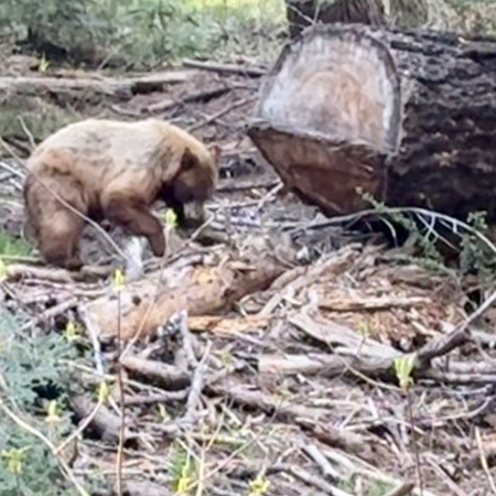
In Seqouia one of our favorite stops was in Crescent Meadow in the Giant Forest or General Sherman area of the park. The Crescent Meadow Loop is a 1.3 mile loop through the big trees along the outside of an oval meadow. Here is where we saw our bear meandering through the meadow and up across the trail. He made his way back down into the meadow and gave us all a nice show. There is an option to add on some additional trails to Squatters Cabin, the Dead Giant, Tharp’s Log or another meadow. Overall we did about 3 miles of hiking very slowly as we sat and watched the bear.
Close by is the .5 mile hike to Moro Rock and a line of cars waiting to get their pictures taken as you drive under the Tunnel Log.
Just up the road is a 1.2 mile look through the Big Trees Trail. And just up from that is the General Sherman Tree which is a .5 mile hike with an optional 2.9 mile add on to see the Congress Trees.
Closer to the Foothills section is Tunnel Rock and Hospital Rock. From the Hospital Rock parking lot there is a trail across the road and just to the right of the rock. This is a quick shimmy down to the river for some amazing views of the rapids.
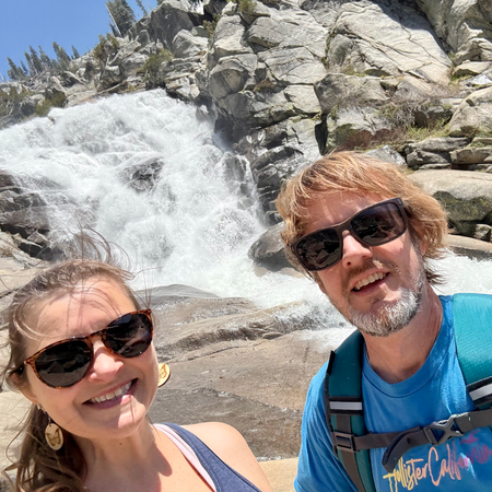
Topokah Falls is one of the prettiest hikes in Sequoia National Park. To access the trailhead, drive to Lodgepole Village and go past the visitor center, through the campground gate, and park in the day use parking and then walk over the bridge to the trailhead.
This is considered a moderate hike because of the rocky terrain and the 616 foot elevation gain. From the trailhead the hike is approximately 1.7 miles out and 1.7 miles back for a 3.5 mile total hike. Along the way, Jonathan took many opportunities to search for fish in the raging river and smaller creeks.
I logged 2.26 miles to the actual waterfall from our parked car making this more of a 4 1/2 mile total round-trip.
The last quarter mile mile is extremely rocky, full sun, and a pretty good elevation gain all in itself. I highly recommend good hiking shoes, a hiking pole and sunscreen.
The trail ends where the mountains come together, and the snow melt runs down culminating in a fabulous display of nature’s power.
It was a good hike for us, the views of the fall are totally worth the effort, and if you’re lucky, you may even see a yellow belly marmot hiding in the rocks next to the falls.
Overall we loved the park from the dramatic river to the towering trees!
More Photos


